


Description
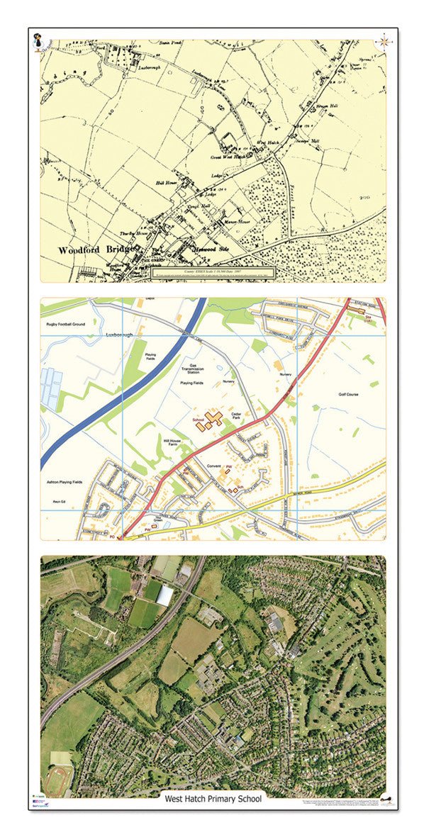
This exciting product contains up to date aerial photography, a historical map from the turn of the century and an up to date Ordnance Survey map. All centred on precisely the same area and at approximately 1:4500 scale, the image covers an area of 2 km from west to east and 1.45 km from north to south. Changes, developments and similarities between the 3 can all be seen clearly. Discover more primary geography resources.
| Pack Size | Each |
| Dimensions | Size: 42 x 89cm |
| Direct Delivery | What is Direct Delivery? |
School Accounts Available
We are an approved supplier to UK schools, trusted by educational institutions nationwide. We accept official purchase orders and offer invoice accounts for schools, making it easy to manage your procurement processes. Simply select the 'Payment on Invoice' option at checkout and we'll do the rest!
If preferred, you can also send your PO by email to orders@springboardsupplies.co.uk